Don't Forget to Take Your Bike
Oregon’s McKenzie River Trail
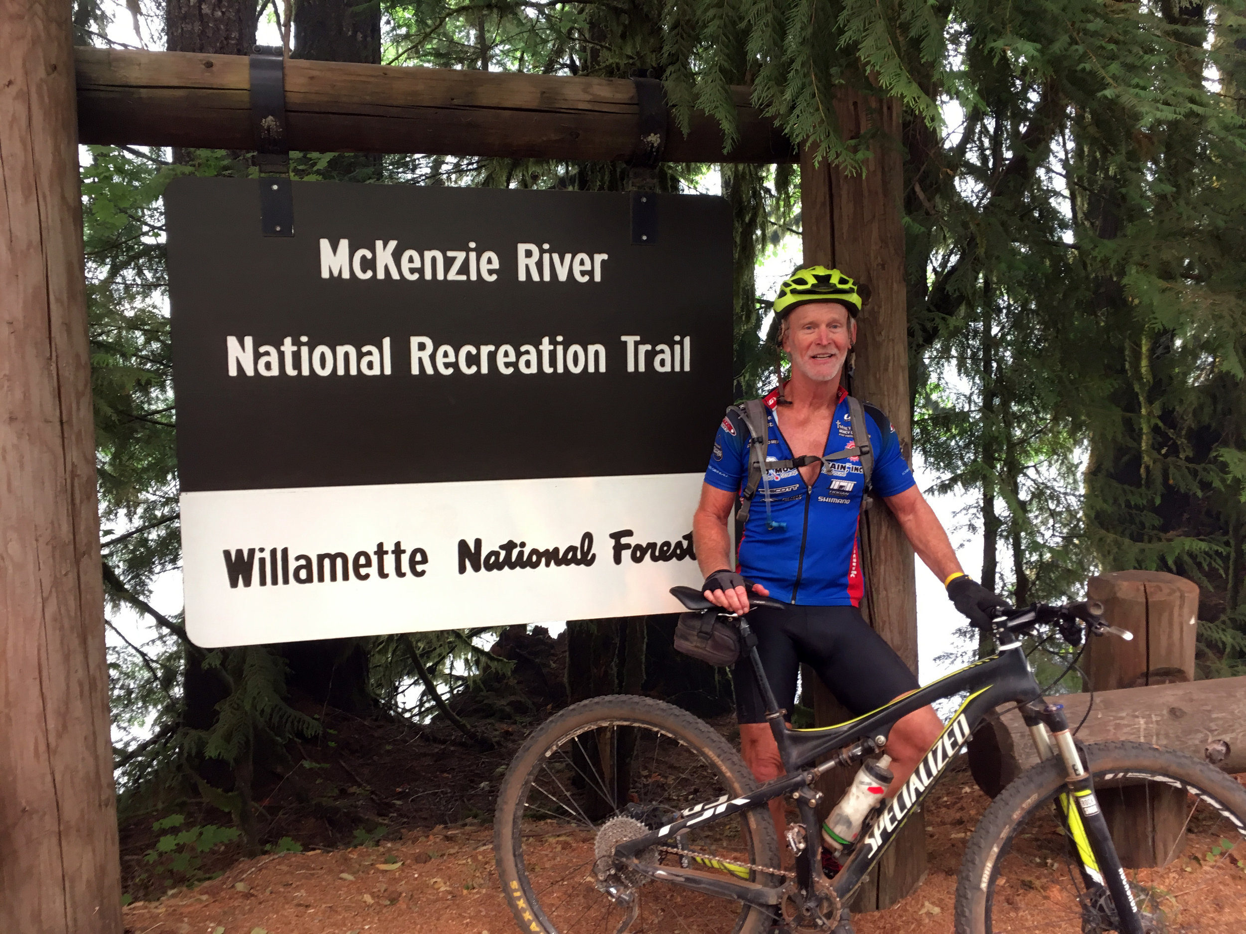
Story & Photography by Bob Robinson


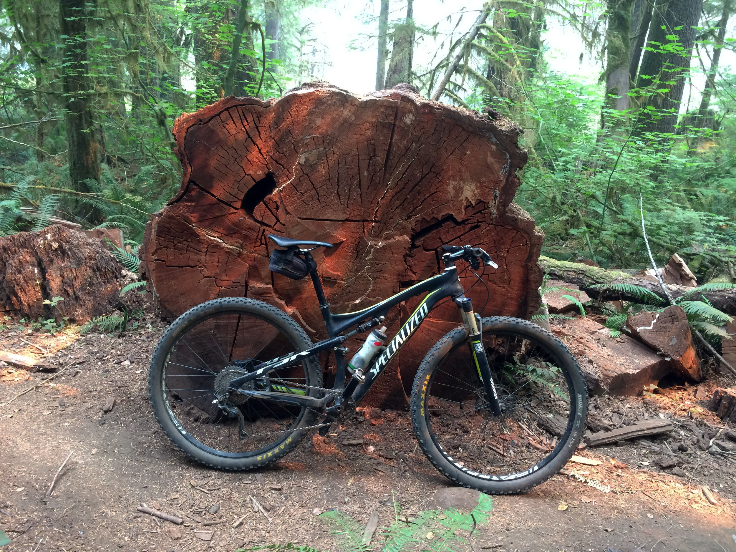
Bob Robinson, author of three bicycle guidebooks, crosses one of several single log bridges that crossed lower wetland areas on the McKenzie River Trail.
Sometimes good fortune just falls in your lap. Like my dad used to tell me, “Bobby, even a blind squirrel stumbles across an acorn once in a while.”
This past summer I “stumbled across an acorn” when my friend Nancy and I were on a trip out west and our friend Michele texted me about a fun mountain bike trail she had heard about located near the area where we were.
That evening I Googled the McKenzie River Trail (MRT). When I read that Bike Magazine named it America’s #1 bike trail, and MTB Project stated, “The MRT is often described as the #1 trail in the U.S.,” needless to say, a detour in our trip was in order.
Start Point: 44.394259-122.002152
End Point: 44.218298,-122.059438

Gushing 100’ Sahalie Falls on the McKenzie River Trail.
The McKenzie River Trail
The southern end of the MRT is located about 50 miles east of Eugene, Oregon, on State Highway 126. You can start your ride at that point to ride an out and back, but that would mean a 3,300-foot elevation gain on your ride out that includes climbing up some extremely gnarly, techy lava rock.
Most sane people are satisfied riding the 26-mile trail just one-way beginning in the north at the Clear Lake Trailhead. Although many people who know me would not agree I fit in the category of “sane people,” I too began my ride at the Clear Lake Trailhead.
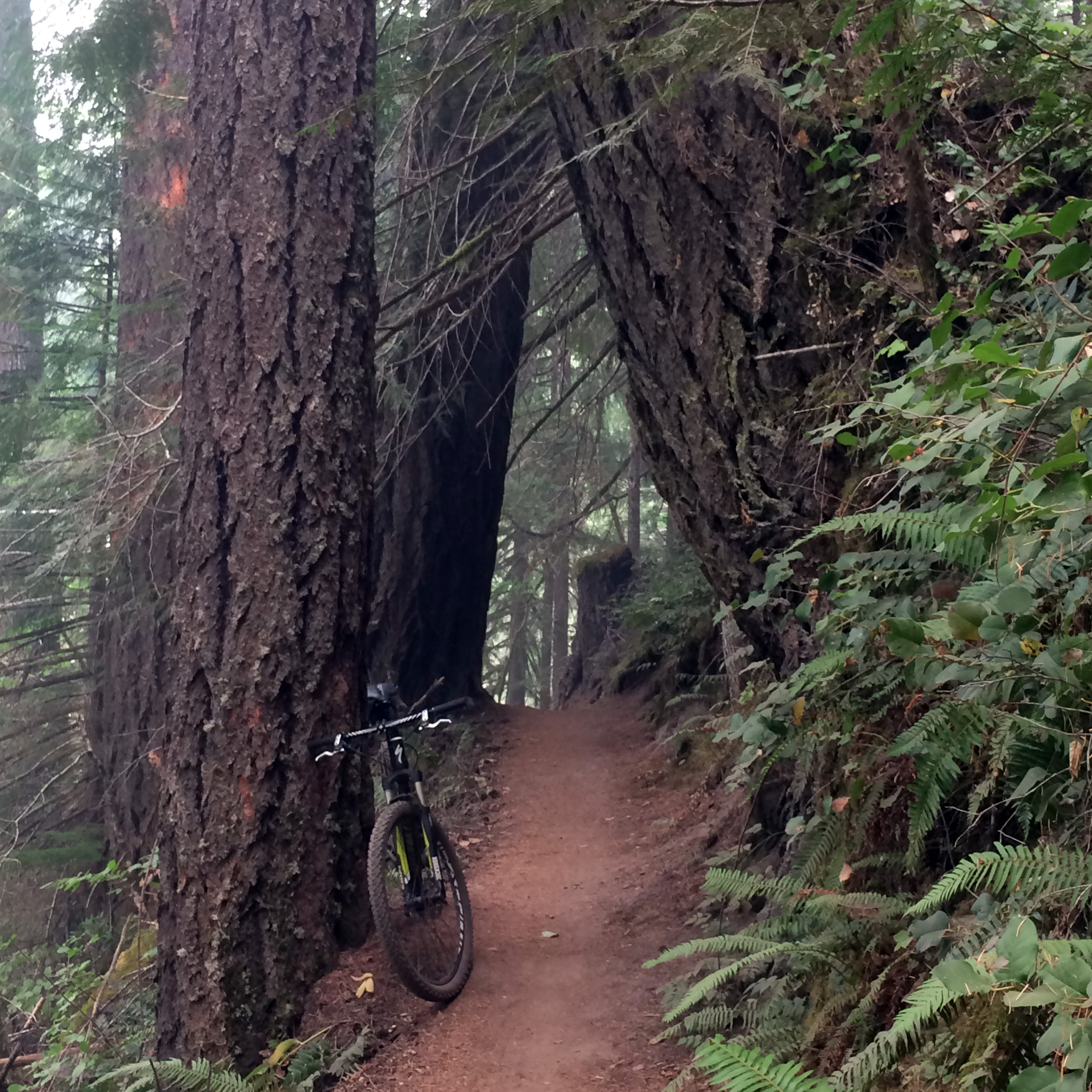
The trail began as a nice four-feet-wide smooth dirt path that wound through healthy old growth coniferous forest. Shortly into the ride the trail split, forcing me to choose between following the east or west shores of Clear Lake. Having read the east side was filled with sharp tire-cutting lava rock, and knowing I would have plenty of “opportunity” to experience lava fields further along the MRT, I chose to not chance cutting my tires so early in the ride. I continued on the west lake shore.
The west side trail soon passed through the Clear Lake Day Use Area with an interesting historic shelter built by the Civilian Conservation Corps in the 1930s. This was a homey community that also had rustic cabins for rent.
Exiting the day use area the trail transitioned to sweet single track with several short fun descents and views between tall giant redwoods of the pristine waters of Clear Lake.
“I found it, whipping through sweeping turns around giant redwood trees, not knowing what would greet me around the corner…”
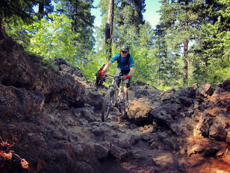
After crossing State Highway 126, I experienced my first encounter with the sharp rough rocks of a lava field. Executing a sustained balancing act, I worked my way over and around these intimidating obstacles.
Soon I noticed a cloud of mist hovering among the trees ahead. After becoming immersed in this low-hanging haze, I paused to peer over a steep ledge into the rainbow-filled chasm of Sahalie Falls.
This 100’ waterfall is the terminus of two thick flows of basaltic andesite lava that moved into the McKenzie River some 3,000 years ago. On the day I was there, massive volumes of water gushed over the jagged lava cliff to plunge into the pool below, the impact of the colliding waters filling the canyon floor with thunderous explosions.
Leaving the falls behind I cautiously maneuvered my way down a long, steep, rocky descent, often pausing to enjoy beautiful views of the foaming white water cascading through the narrow river canyon that bordered the trail. Soon I passed an equally impressive Koosah Falls.
The names of the falls came from Native Americans who once followed these same paths along the McKenzie River foraging for food and en route to trade in the Cascades, with Sahalie meaning “Heaven” and Koosah “sky.” The McKenzie River is one of the few rivers in Oregon that did not retain its Native American name, instead being named after Donald McKenzie, an early European expedition leader in the area.
A lava flow from the Belknap Crater 1,600 years ago buried a three-mile stretch of the McKenzie River, sending the water underground after leaving the second falls. The bike trail then bordered a dry river bed, snaking its way through heaping piles of hardened, jagged lava flow.
Soon the short intermittent stretches of the rocky trail that were at least rideable disappeared, and it became an the endless fight to remain upright. With uninviting sharp-edged lava mounds bordering the trail, I finally gave in and my fun jaunt through the forest became a hike-a-bike.
My efforts were rewarded with a scenic third cliff-rimmed basin vista from the crest of Tamolitch Falls. The falls themselves are not that impressive because they are usually dry. It is the pristine turquoise blue-colored pool some 49 feet below that has attracted visitors to the area for thousands of years. Blue Pool, as it is called for obvious reasons, is where the McKenzie River resurfaces to continue its journey above ground.
There were a number of hikers on the trail after leaving Blue Pool who had begun their walk at the nearby Tamolitch Falls Trailhead. They were very friendly and accommodating to bikers, or else they moved out of my way in fear of my falling on them as I resumed my attempt to ride through the lava field.

A tree clogged tributary alongside the trail.
Soon the lava features were behind me, and the trail evolved into a gently sloping smooth dirt single track, with just enough narrow exposed ledges, surprise rocks and exposed roots to keep it exciting.
Even though I knew I should take my time and enjoy the beautiful scenic surroundings, after the lava fields I was in bad need of an adrenaline fix. And I found it, whipping through sweeping turns around giant redwood trees, not knowing what would greet me around the corner, but confident I would make the split-second decision needed to guide me safely through.
With the end of my MRT adventure rapidly approaching, even though my legs were burning, I cranked it up a notch to push myself even faster. It would be a crime to end such an epic adventure leisurely pedaling across the finish.
As I enjoyed a post-ride craft beer, I contemplated what was so special for the MRT to rate being the #1 mountain bike trail in the country?
Sure, it contained super-fun downhill certain to fulfill a cyclist’s adrenaline fix, but I’ve ridden faster routes on other trails. And, yes, the waterfalls, dense redwood forest and the cascading river provided a natural picturesque setting. But I have ridden several mountain bike trails in other states that are equally as scenic. And the technical jagged lava rock does challenge a rider’s skill set. But once again, I’ve ridden harder trails. And that last 14 miles of winding flowy single track had me smiling so much my cheeks were almost too sore to smile for the post-ride photograph.
Then I realized why the MRT is #1—the McKenzie River Trail has all of this on one trail!
So next time you hit the highway, take your bike and find your acorn.