A Buffalo River AdventureA trip 30 years in the making
By Rob MoodySTORY & PHOTOGRAPHY by Bob Robinson

Bill Steelman (back) and Grant Nally (front) enjoying an up-close look at one of the many bluff walls bordering the Buffalo River.
When Bill Steelman, a backpacking friend of mine, asked me to join him to float the Buffalo River, I thought to myself: Five days on the crown jewel of the Natural State, drifting at the base of sheer bluffs towering over 400 feet above, sleeping on polished rock shoals, fishing for smallmouth bass, exploring old homesteads that once called the river valley home, swimming daily in emerald green waters and Steelman guaranteeing I would gain weight because there would be no dehydrated backpacking meals on this trip.
“Sign me up,” I promptly replied.

Bill Steward casting a line in the Buffalo River.
The Buffalo River float has been an annual adventure for Steelman and Grant Nally for almost 30 years, with Jack Moffett and son Sam becoming regulars after the first few years. I invited Bill Steward, with whom I had shared numerous outdoors adventures, to make it a crew of six.
This year’s trip was all the more significant for Steelman, having successfully completed prostate cancer radiation treatment several months earlier. With his Gleason score dropping like the waters of a stream in days following heavy rain, he was ready for their outdoor adventure.
Let the Adventure Begin

Top: Bill Steward casting a line in the Buffalo River. Below: Bill Steward hiking up Panther Creek en route to Indian Rockhouse.
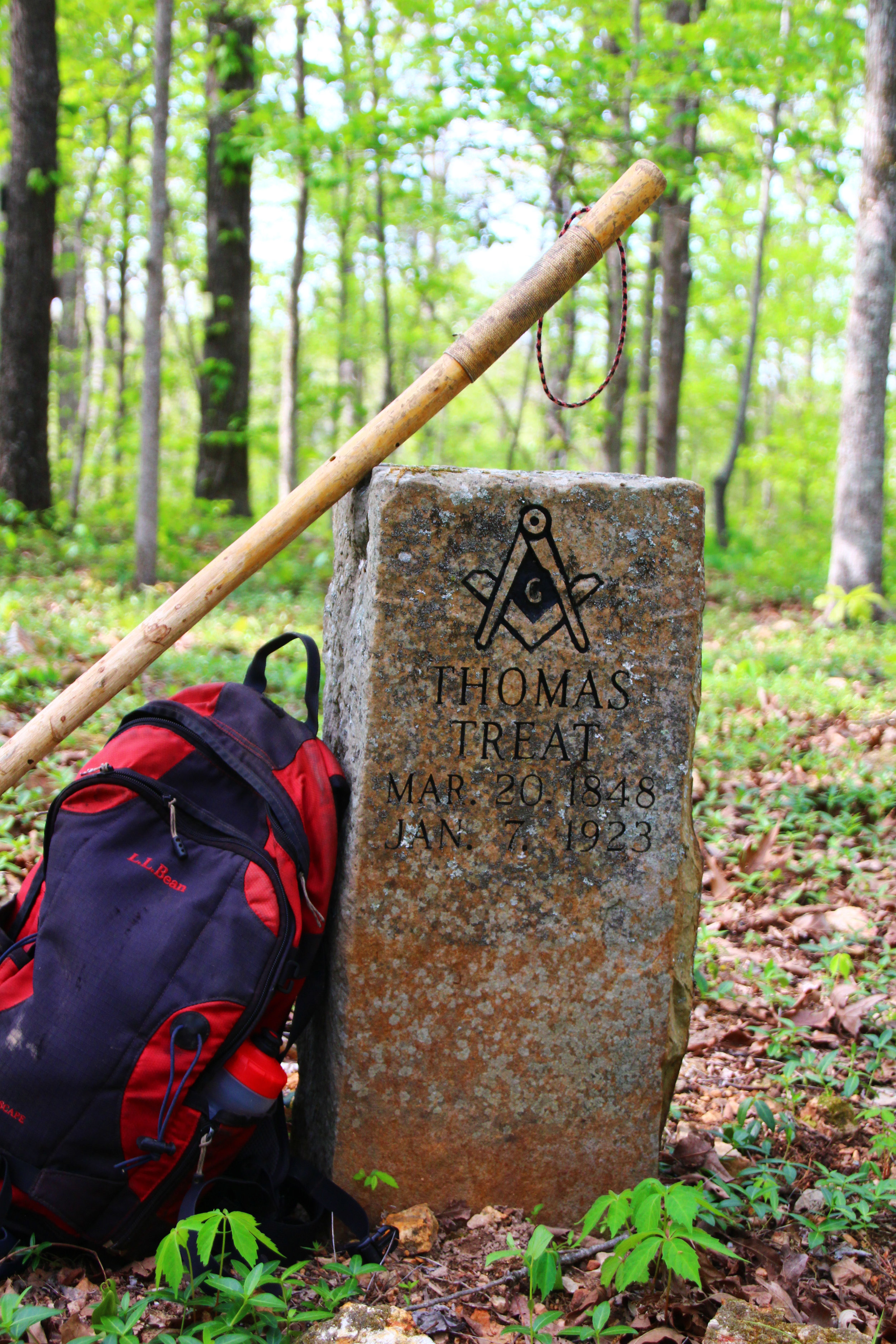
Our plan was to car camp at the Maumee South Landing Tuesday night. En route, I took a detour down Zack Ridge Road for a hike to an old pioneer cemetery and visited the 1910 Missouri & North Arkansas Railroad (MNAR), the only remains of which are a massive set of concrete columns in the Buffalo River bed. Towering some 60 feet above the waters, it was difficult to visualize the December 1982 scene when flood waters covered the tops of the structures.
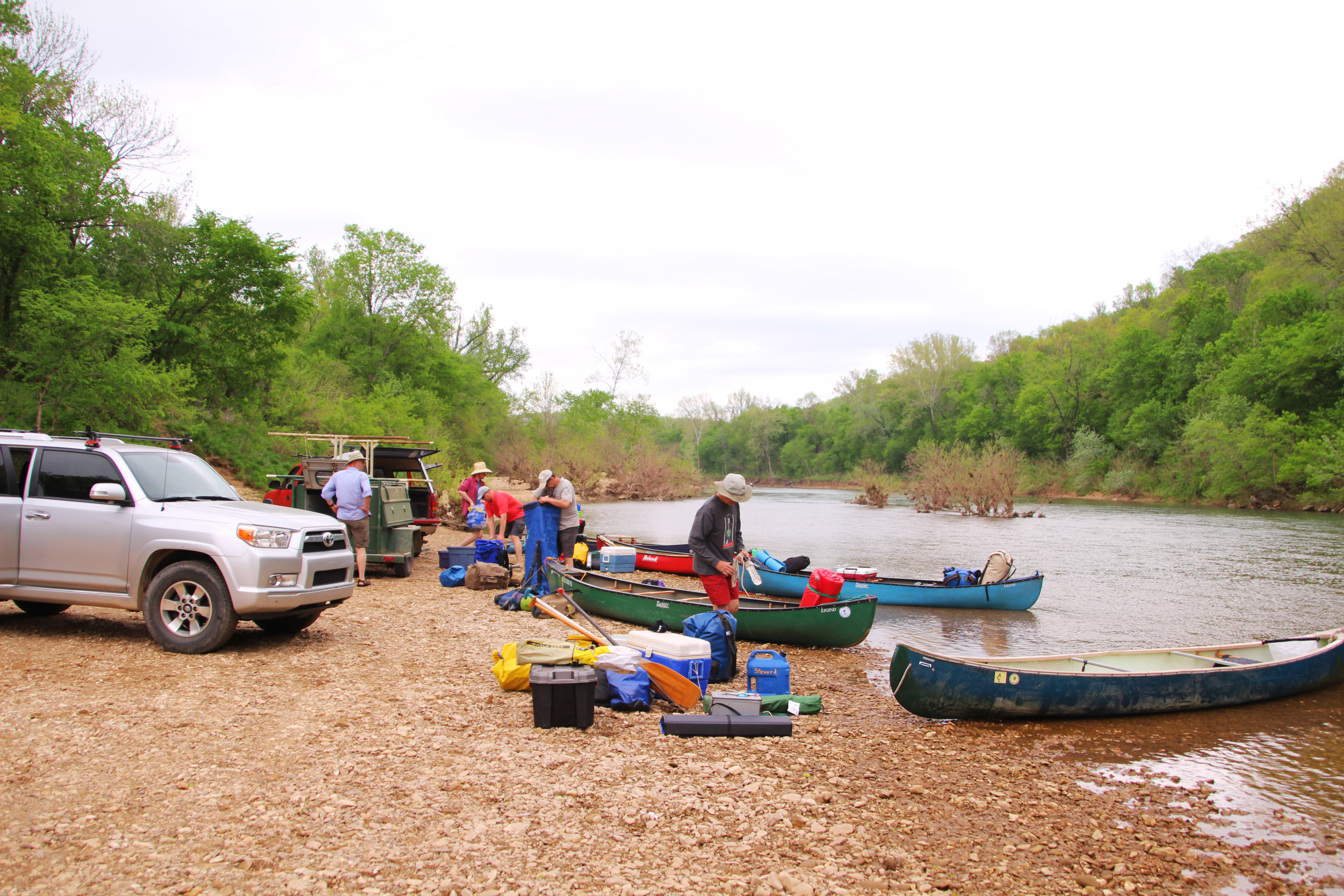
With all members present and accounted for, early Wednesday morning we headed to Wild Bill’s Outfitters to arrange shuttle service to Gilbert Landing.
Canoes loaded high with all the necessities to live like pampered kings on the river for the next five days, our river adventure began. With my phone stashed in my vehicle, I severed all contact with the outside world as I pushed my boat off the shore.
The only paddling required at the current river flow was to keep the canoe pointed downstream. There were occasions we didn’t even bother with that. We were soon gently drifting past the base of the MNAR concrete columns I had photographed the previous day from the bluff high above.
Following this we maneuvered a river bend at the base of colorful Red Bluff. For those knowledgeable enough to read them, the 260-foot rock formation would have an interesting story to tell. The layers of St. Peter Sandstone, St. Clair Limestones and Boone Formation would read like a biography on the ancient history that formed the river valley.
Prior to the trip, I read Ken Smith’s Buffalo River Handbook to learn that many early settler homesteads bordered the banks of the mighty river, their memories preserved in the names of bluffs and river landings. Reading this gave me a healthy appreciation of the area during the float.
Early afternoon we moored our vessels on what everyone felt certain was the best campsite on the river. Located on a gravel bar just past Little Rocky Creek across from an unnamed bluff, it offered everything we were looking for.
With rain forecast the following day, the plan was to extend our initial campsite to a second night. Rigging a common shelter among the trees on the riverbank, we planned to remain high-and-dry while watching the rain and river flow.
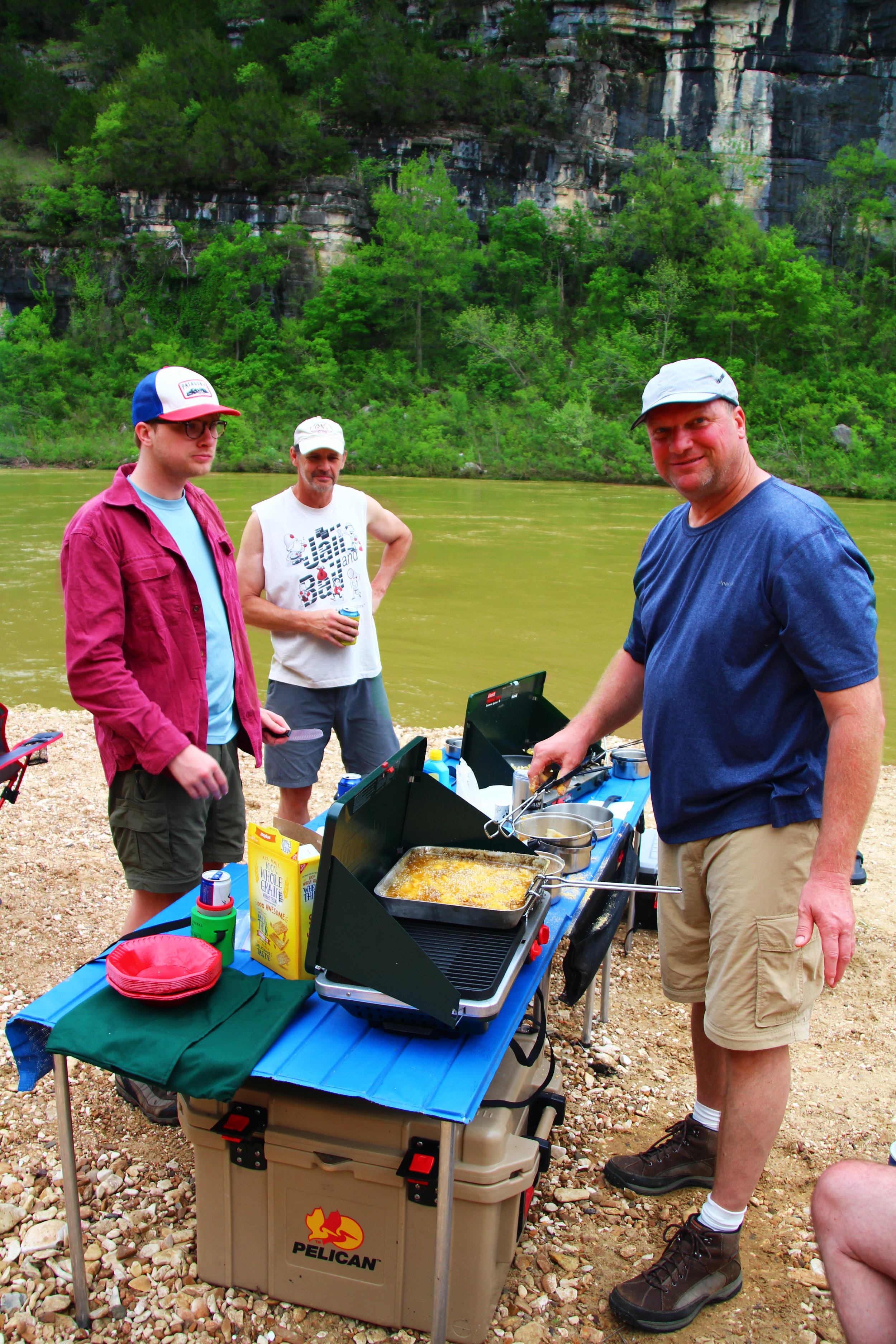
After setting up camp, while sitting in my chair enjoying an adult beverage, Moffett began serving boiled shrimp dipped in heavy cream sauce while Steelman grilled steaks for dinner. I decided Steelman was right; I probably would be gaining weight on the trip.
Prior to turning in for the night, we installed a rain gauge (a stick driven in the ground at the water’s edge) to monitor changes in the river level. At that time, it was merely for curiosity’s sake.
CHANGE IN PLANS
Sometime after midnight I was awakened from deep slumber by the sharp crack of thunder. Opening my eyes, the tent poles overhead were outlined by a bright flash of light. As I became more conscious, I could hear the gentle patter of raindrops pelting my rainfly. However, my MSR Hubba Hubba tent kept me warm and dry, and I soon drifted back to never-never land.
Peering out the tent the following morning, I saw that the rain was still falling and our river gauge was completely submerged. After everyone eventually emerged from their tents, we gathered under the common area shelter. While sipping hot chocolate and coffee, we calmly discussed our options.
With the previous day’s weather forecast predicting only three-tenths inch of rain for the entire day, and the water level still 25 feet from our camp, we set a new rain gauge, deciding to monitor the water’s progress, while Chef Moffett prepared a batch of delicious breakfast burritos.
As the morning progressed, the rain was unrelenting and the river continued its assault up the gravel bar. Luckily for us, Sam Moffett is a math major. Doing the arithmetic, with the river advancing at a rate of one foot per half an hour, and with our campsite now less than 20 feet from the water level, unless we wanted to be floating around on our mats in our tents, we were going to have to relocate to higher ground.
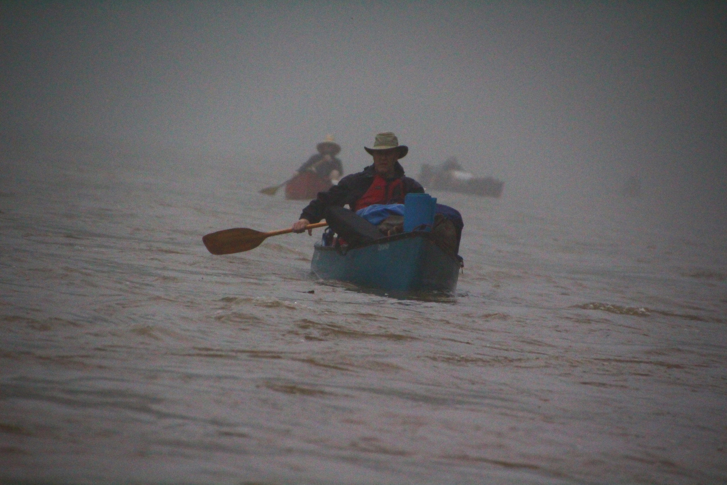
During the next lull in the rain, we quickly gathered up camp and launched into the now swift waters of the Buffalo.
Even with the rain, at times, creating a curtain of water, I remained comfortable in my rain gear. With the heavy downpour, the bordering hillsides were adorned by countless cascades and waterfalls, and it turned out to be a magical experience.
As the rainfall weakened, we docked our boats river left on a rock bar across from the imposing 360-foot formation called Spring Creek Bluff. Nally had marked the spot on the map as a favorite campsite from previous floats. Even at the current river level, there remained 15 feet of beach at the base of a gravel bench elevated another eight feet, large enough to accommodate our camp.
This was to be our home for the next couple of nights as we awaited a drop in the river level. The map listed a cemetery a couple miles away we could explore the following day, plus we could fish eddies along the shore.
LIFE IS GOOD

Father Jack Moffett (left) and son Sam (right) sharing the beauty of Painted Bluff together.
As we lounged on the gravel bar the following day, Rangers Adam Bass and Chris Watson pulled their power boat onto the shore of camp. With three inches of rain resulting in a 12-foot rise in the river level, it is standard procedure for them to patrol the river to check on the safety of floaters.

Top: Bill Steelman leading the group through the pouring rain.
Bottom: Home away from home on a gravel bar across from majestic Spring Creek Bluff.
After discussing river conditions and sharing our story of the evacuation of our previous campsite, they decided we knew what we were doing and continued downriver to check on others.
The weather cleared and the conditions became near perfect. Life was so good at the camp that we contemplated extending our stay for a third night. However, we had a hike planned further downstream and knew if we remained, there would not be time.
FINISHING IN STYLE
As I zipped open my rainfly at daybreak, I startled a Great Blue Heron walking on the gravel bar in front of my tent. The stately bird gently lifted off the polished rocks to gracefully glide upriver maintaining a three-foot interval above the water. This is how every day should begin.
Following a breakfast of biscuits, which Steelman prepared in a Dutch oven, layered with sausage gravy and a large helping of Moffett’s delicious, crisp hash browns, we continued our voyage.
The sun shined brightly overhead as we leisurely drifted downstream. Nally occasionally peeled into an eddy to drop a fishing line, but everyone was generally content with allowing the river current to dictate our pace.
We maneuvered our canoes into the entrance of Panther Creek for a hike to Indian Rockhouse. With the swollen river’s waters backing up into the drainage, we were able to paddle our boats several hundred feet upstream. At that point, Steward and I secured our boat to continue on foot. The others had made the hike on previous trips and chose to have lunch in the shade of the bordering trees then continue to our next campsite.

A family enjoying Indian Rockhouse, with Bill Steward enjoying the warm sun.
With steep earthen banks bordering both sides of the drainage, we chose to wade up the creek bed. Within a mile we reached a maintained trail coming from the highway.
Indian Rockhouse is the second largest shelter cave in the Buffalo River valley, with a 30-foot ceiling and measuring 270-feet across its massive opening. There is also an underground stream at one end that flows from the mouth of a smaller cave, through Indian Rockhouse, and disappears into a third cave.
When we joined the group, they were setting up camp on the gravel bar across from Ludlow Bluff, towering almost 600 feet above the river.
That night, Chef Moffett grilled steelhead trout over wild rice. As we enjoyed our meal on the banks of the river, a bald eagle glided upriver some 20 feet away.
Our last night on the river was under a ceiling of bright twinkling stars. More tales of prior adventures were shared as our Buffalo River Adventure was coming to an end. Just two miles from our takeout at Rush Landing, I savored the evening then slept soundly in my cozy nest.