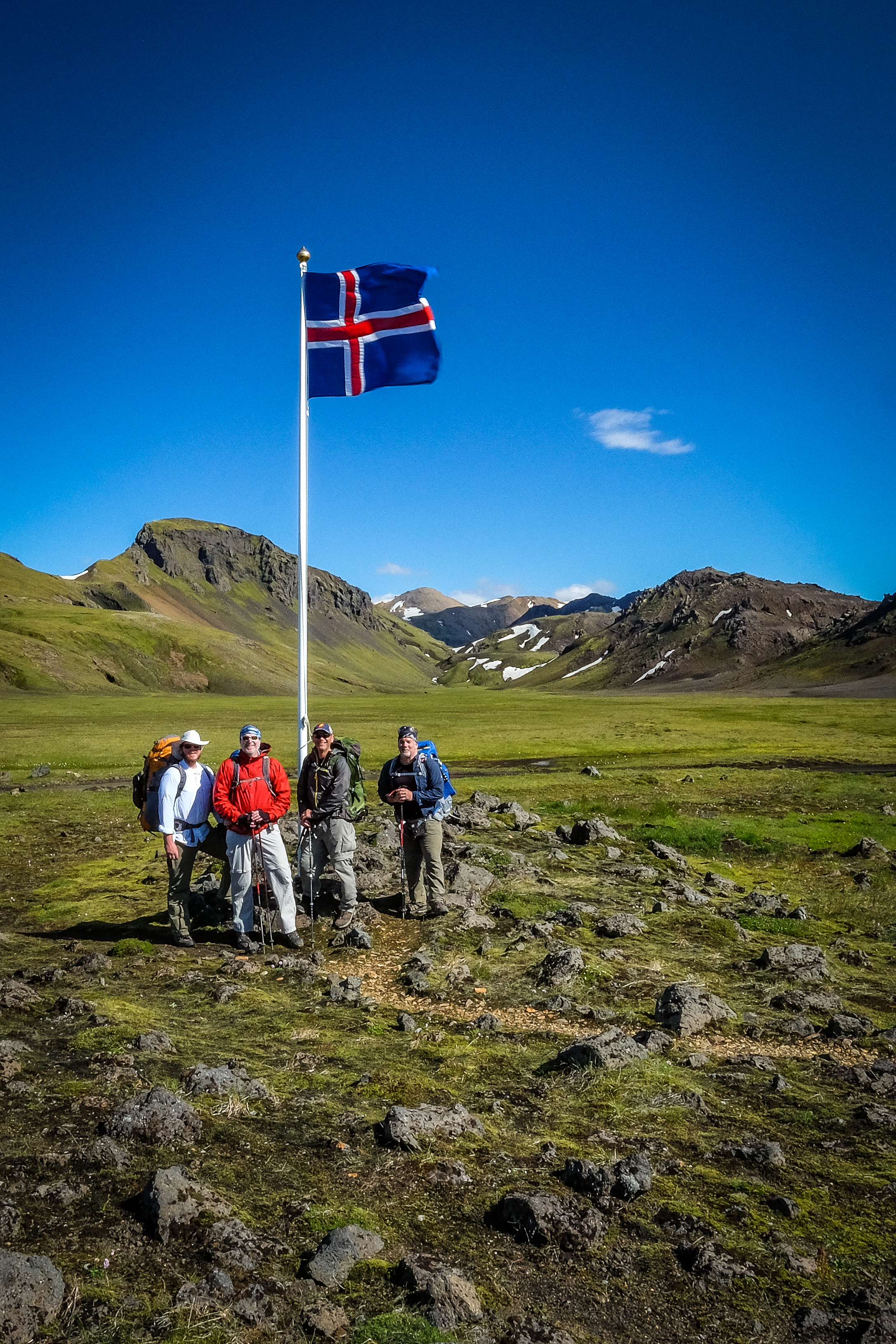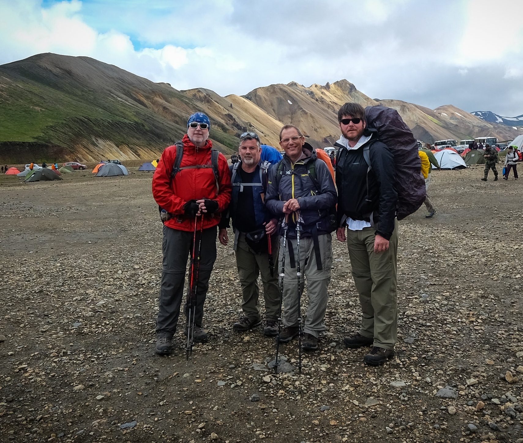
Darren Brodie, Darrell Potts, Kevin Maestri and Matthew Hegi pose at the trailhead before beginning their four day adventure.
THE ADVENTURERS:
Darrell Potts – Lewis & Clark Outfitters Dude/Purveyor of Omni-Wool Socks and Base Layer/Unofficial Expedition Photographer/Knee Brace Tester
Kevin Maestri – Owner of US68 Cycling Apparel/Delivery and Logistics Coordinator for Pippin Apple Pies/Icelandic language interpreter
Darren Brodie – Optimistic Optometrist at Boozman-Hof Eye Surgery and Laser Center/Lieutenant Colonel (or Lieutenant TO the Colonel) in the U.S. Air Force Reserve/Uncertified Dietician
Matthew Hegi – J.B. Hunt C.P.A./Avid Walker/Former All-Star Junior High City League Flag Football Place Kicker (kickoffs, but not field goals)/Rental Car Coordinator and Head Expedition Driver
Every year, my humble crew of adventurers attempts to put together something epic. Every four or so years, we actually get permission from all our wives to embark on such a trip. This time, permission was granted (mostly) and the planning began.
Matthew was so excited about the prospect of escaping diaper duty for a week, he offered to make his famous crab bisque soup for our planning meeting. So, there we were, sitting around the Hegi dining table eating a truly exemplary bowl of crab bisque without crackers (but the soup was so good nobody wondered where the crackers were), when somebody said “Let’s go to Iceland.” There was only a pause of about two seconds before all four of us were in.
I pulled out my iPad, and after a few minutes Googling things like “hiking in Iceland,” “Iceland adventures,” and “do they serve crackers with crab bisque in Iceland,” we found what sounded like the perfect adventure: The Laugavegur Trail.
ARRIVING IN ICELAND:
Pretty much every Iceland adventure begins and ends in the capital city of Reykjavik. It’s a pretty small city--not much bigger than Springdale--but with an ocean, shipyards, snow-capped peaks and staggering rock formations saluting the jagged shoreline.
Something about Reykjavik just feels right. The air is crisp, the atmosphere is picturesque and there’s an unspoken comradery between all of the Patagonia/Arc Teryx-clad adventurers prepping for tomorrow’s adventures. Everybody downtown looks like they just stepped out of a modeling school for mountaineers.
PARKING THE RENTAL CAR AT THE TRAILHEAD:
Let the backpacking begin! Just one thing stood between us and perhaps the most revered trail in the world: a puddle in the road. I’m not going to question Matthew Hegi’s masculinity, his adventurous spirit, or even his driving ability. I’m just going to say when Matthew Hegi drove up to that puddle in that Iceland road, he froze.
He was trembling, clutching the steering wheel with ghost-white knuckles, unable to make any sort of decision at all. We thought he was kidding, but he never laughed. Brodie was seated up front next to Matthew staring in silent disbelief as his once proud friend started mumbling about rental agreements, the dangers of moving water, and more about rental agreements! He even suggested we park the car and wade through the freezing water to get to the area where dozens of other rental cars had already gone.
What happened next was memorable. Darren verbally berated Matthew like a high school linebacker might treat a third-string punter on the other team. He called Matthew names I haven’t heard in decades, he shouted commandments, he stomped the floor of that little Rav4 SUV, he pointed, and he verbally beat Matthew into submission. Just as a Corolla full of college-age girls crossed the puddle in front of us, Darren told Matthew: “Drive! Now!”
Halfway across the puddle, Kevin sensed Matthew was dangerously close to slowing to a stop. Not wanting Matthew to slow down, Kevin did what any true friend would do; he started screaming. “Water is coming in the doors, water is coming in!” Kevin shouted. “What did the rental agreement say about water damage?” I yelled. “No! Are you serious?” Matthew screamed. “Drive, you moron, drive!” Darren yelled.
We pushed our friend beyond his comfort zone, and in so doing helped him grow. I think he became a better man that morning. And that rental agreement would have nothing to say about his future as a stronger father. Three strong friends lifting up a fourth friend to their level … beautiful.

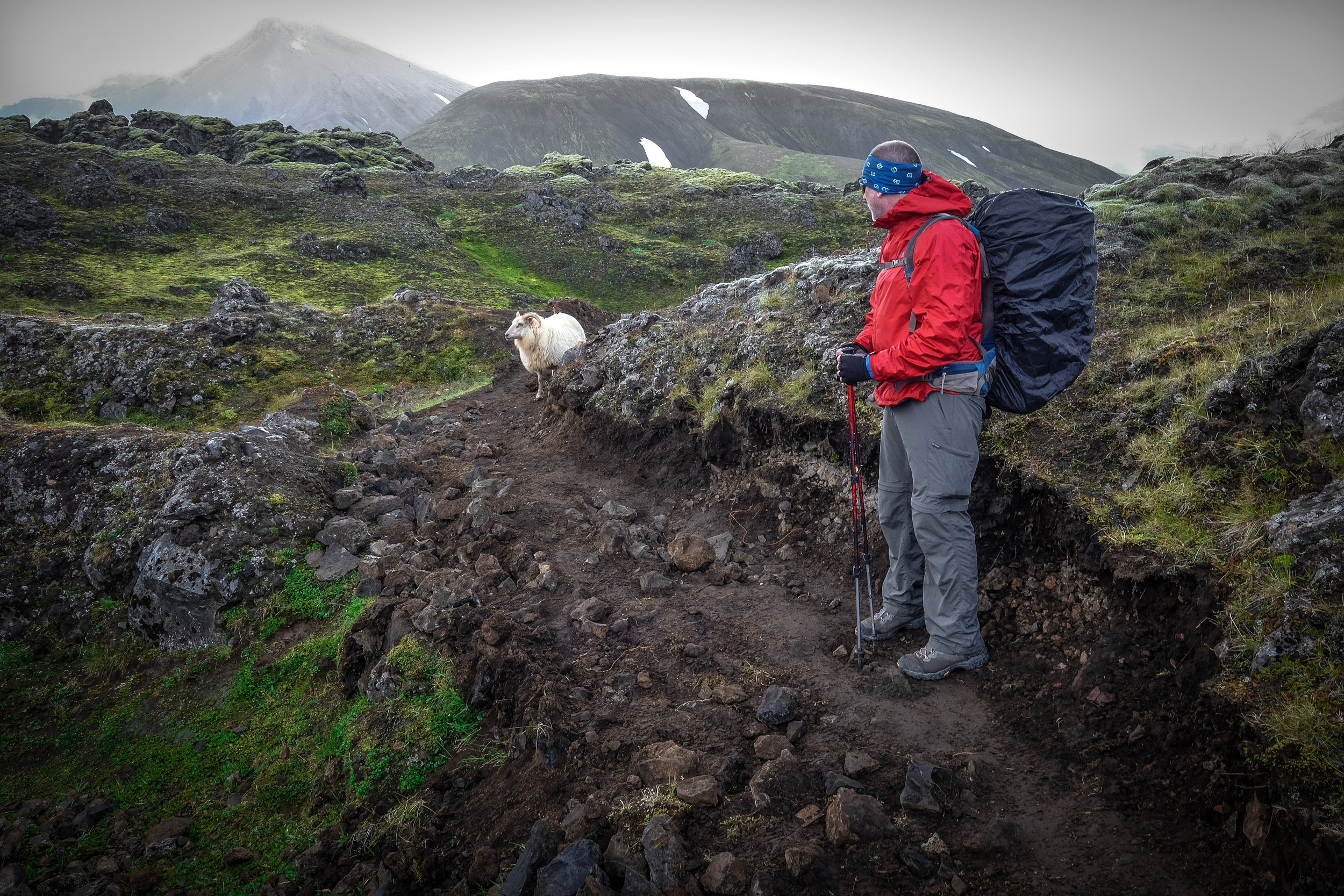
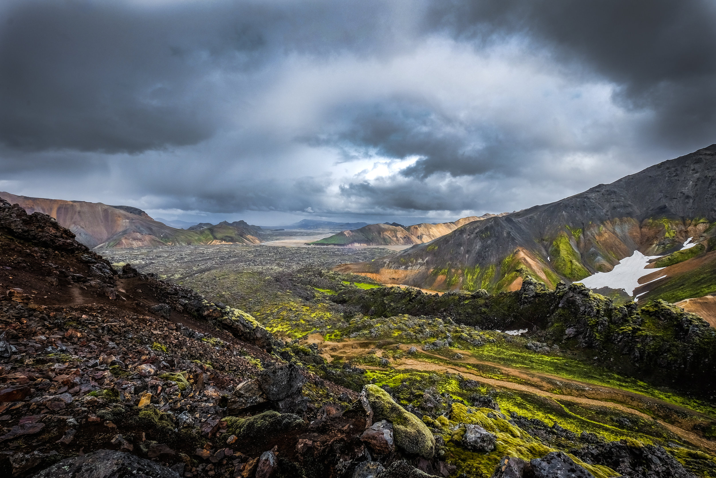
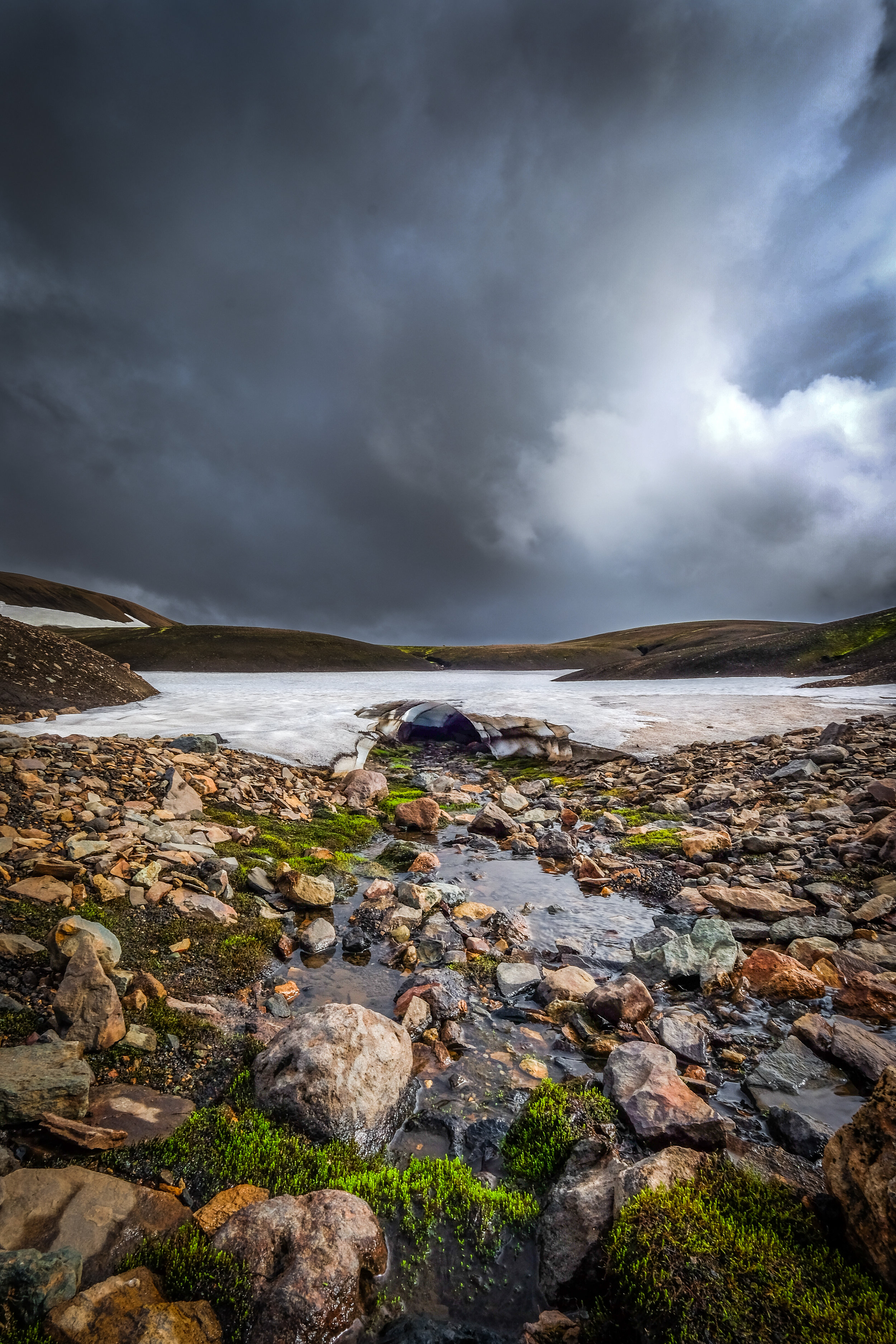
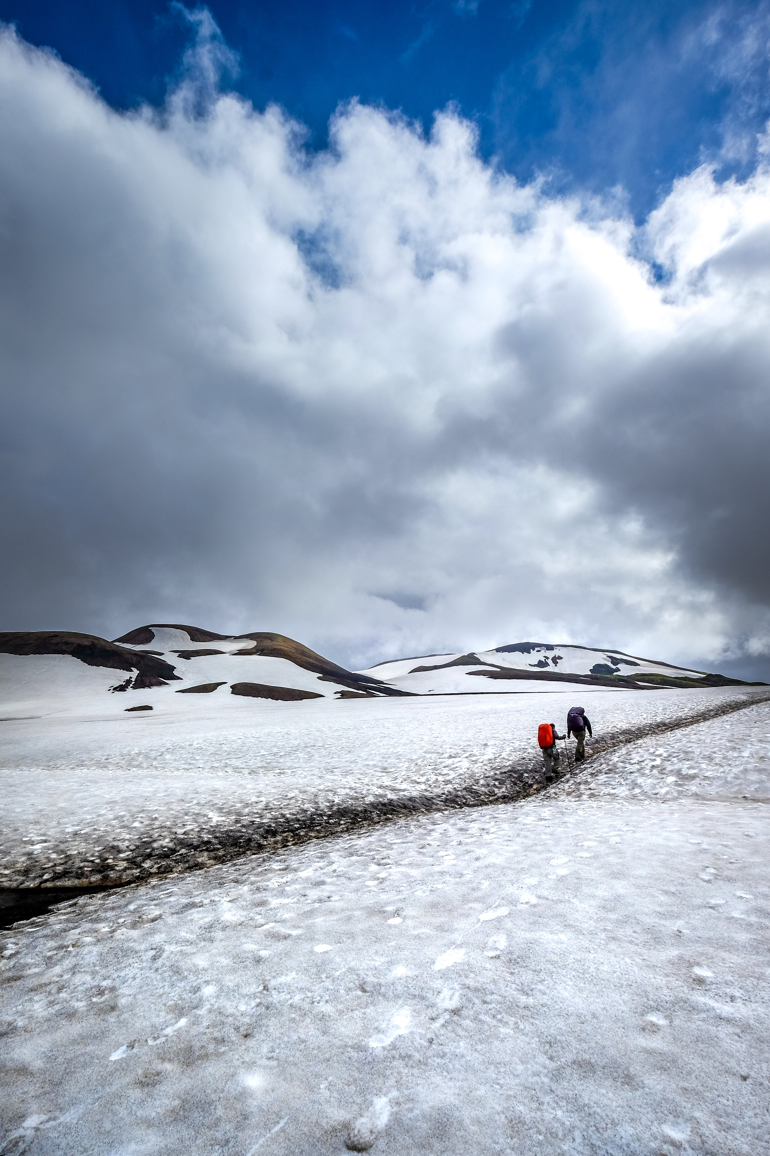
Top to bottom: Less than a mile from the start, we encounter wildlife—sheep, in this case. Otherworldly landscapes in every direction as we hike toward Hrafntinnusker. Taking a short break during our first glacier crossing.
DAY ONE:
Landmannalaugar - Hrafntinnusker
Distance: 8 Miles, 4 – 5 hours
Elevation increase: 470 m
Start coordinates GPS:
N63°59.600 – W19°03.660
Finish coordinates GPS:
N63°55.840 – W19°09.700
Elevation increase: 470 m
Start coordinates GPS:
N63°59.600 – W19°03.660
Finish coordinates GPS:
N63°55.840 – W19°09.700
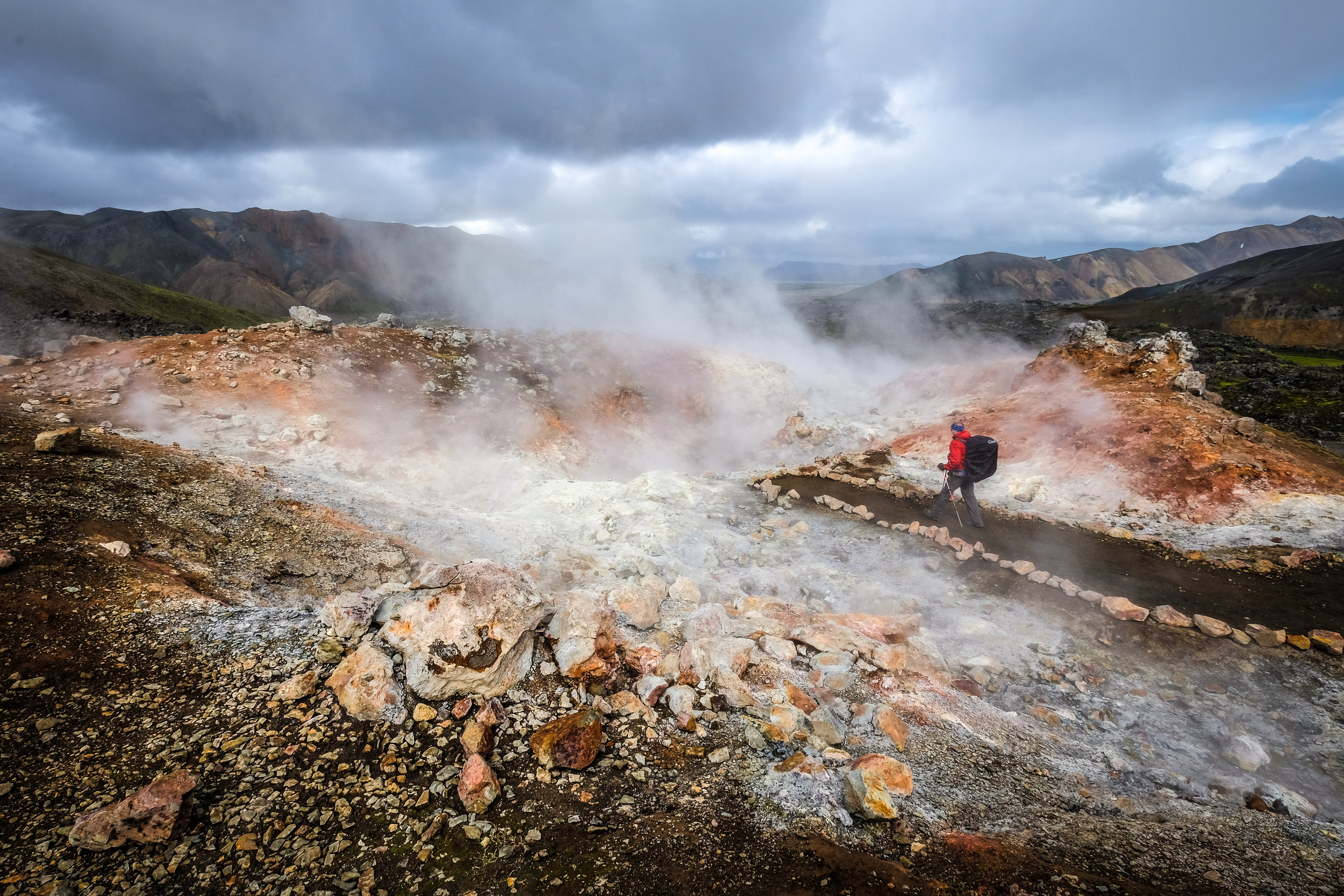
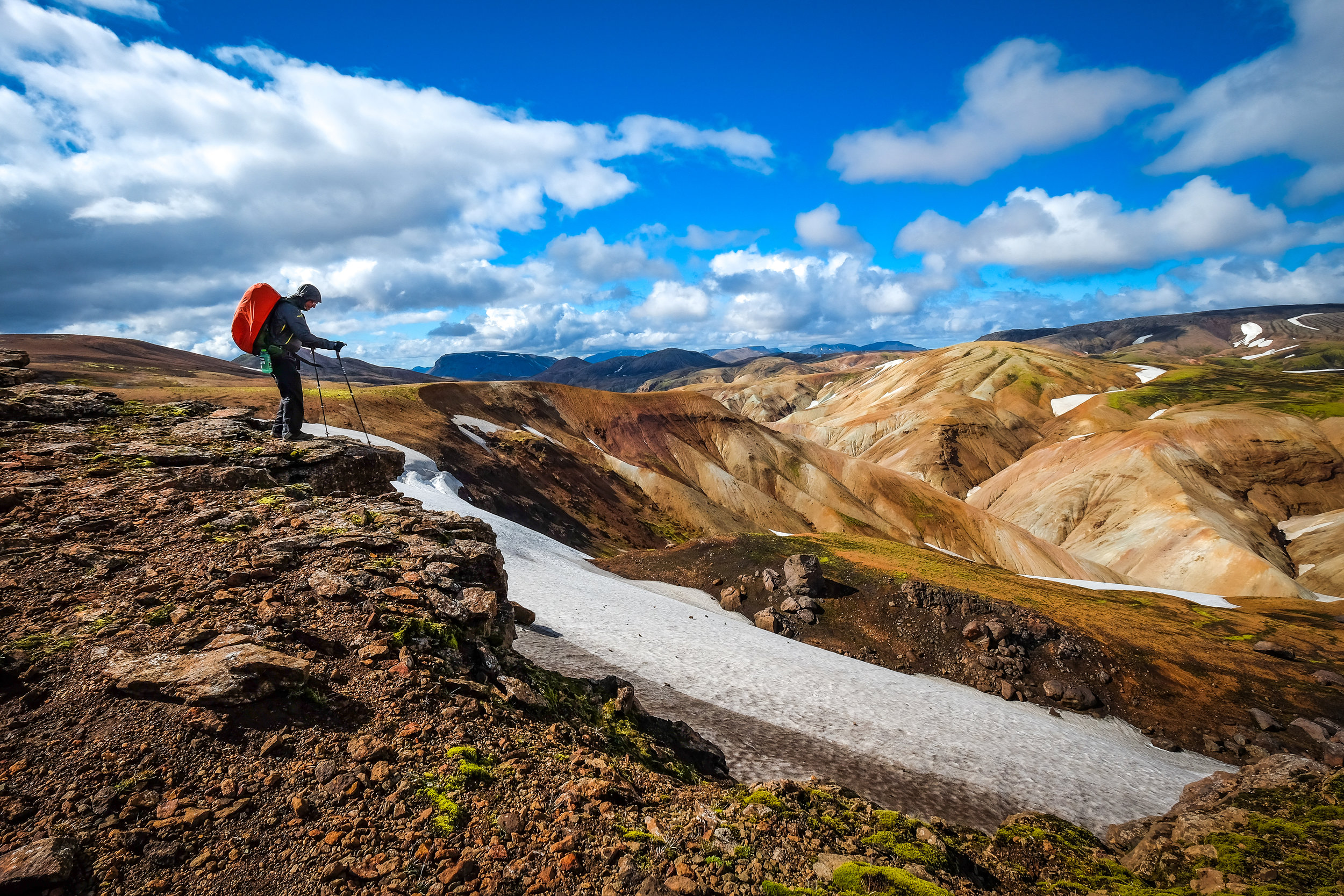
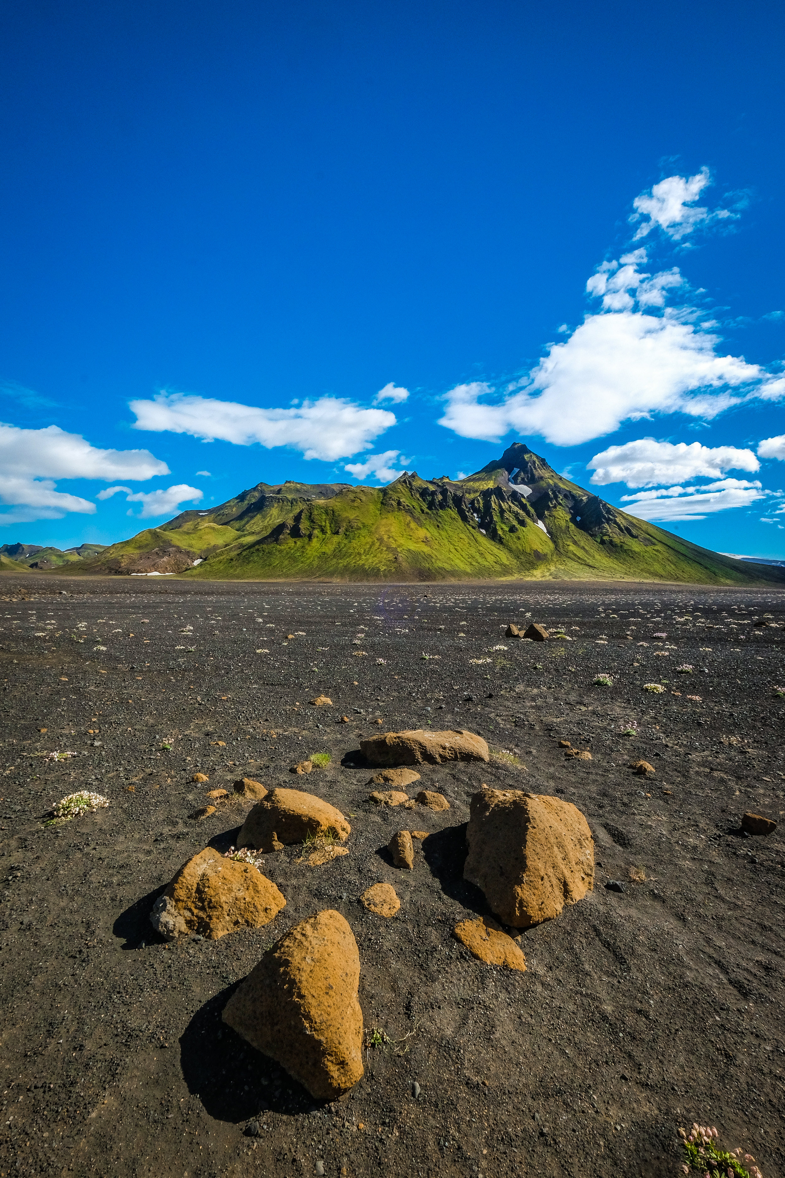
I don’t know how to describe the trail. You don’t have to wonder if you’d like it. (You would.) You don’t have to wonder if it’s incredible. (It is.) The ground was boiling with volcanic activity. Rams met us in the first mile of the rocky trail to stake their claim on very green grass, while bright red dirt gave way to steam and steaming pools of water. I almost expected a Hobbit to come around the next corner, setting up a picnic for elevensies.
Starting from Landmannalaugar, the early hiking was easy. We hiked through the lava field of Laugahraun towards very colorful snow-capped mountains. There was a long, gradual climb through picturesque hills of orange, red, brown and white. After a few hours, we arrived at Storihver geothermal area and hot springs.
Right after an impromptu steam bath on the side of a mountain, it started to snow and sleet across our faces. We were thankful for good visibility when we came across a memorial of a hiker who died of hypothermia in that spot a few years ago. He was just about a mile from the campsite and hut at Hrafntinnusker.

DAY TWO:
Hrafntinnusker - Alftavatn
Distance: 7 miles, 4-5 hours
Elevations decrease: 490 m
Start Coordinates GPS:
N63°55.840 – W19°09.700
Finish coordinates GPS:
N63°51.470 – W19°13.640
Elevations decrease: 490 m
Start Coordinates GPS:
N63°55.840 – W19°09.700
Finish coordinates GPS:
N63°51.470 – W19°13.640

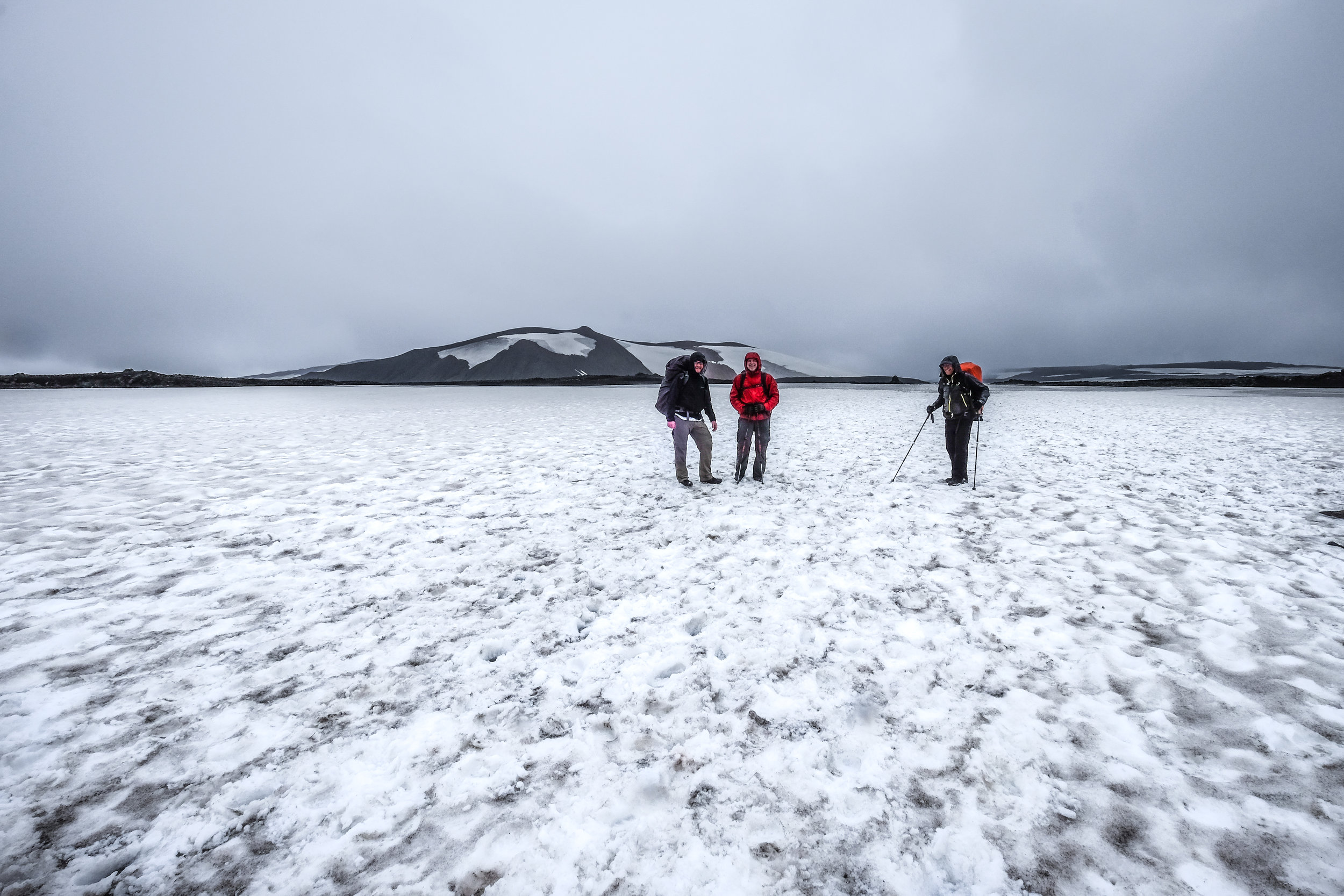
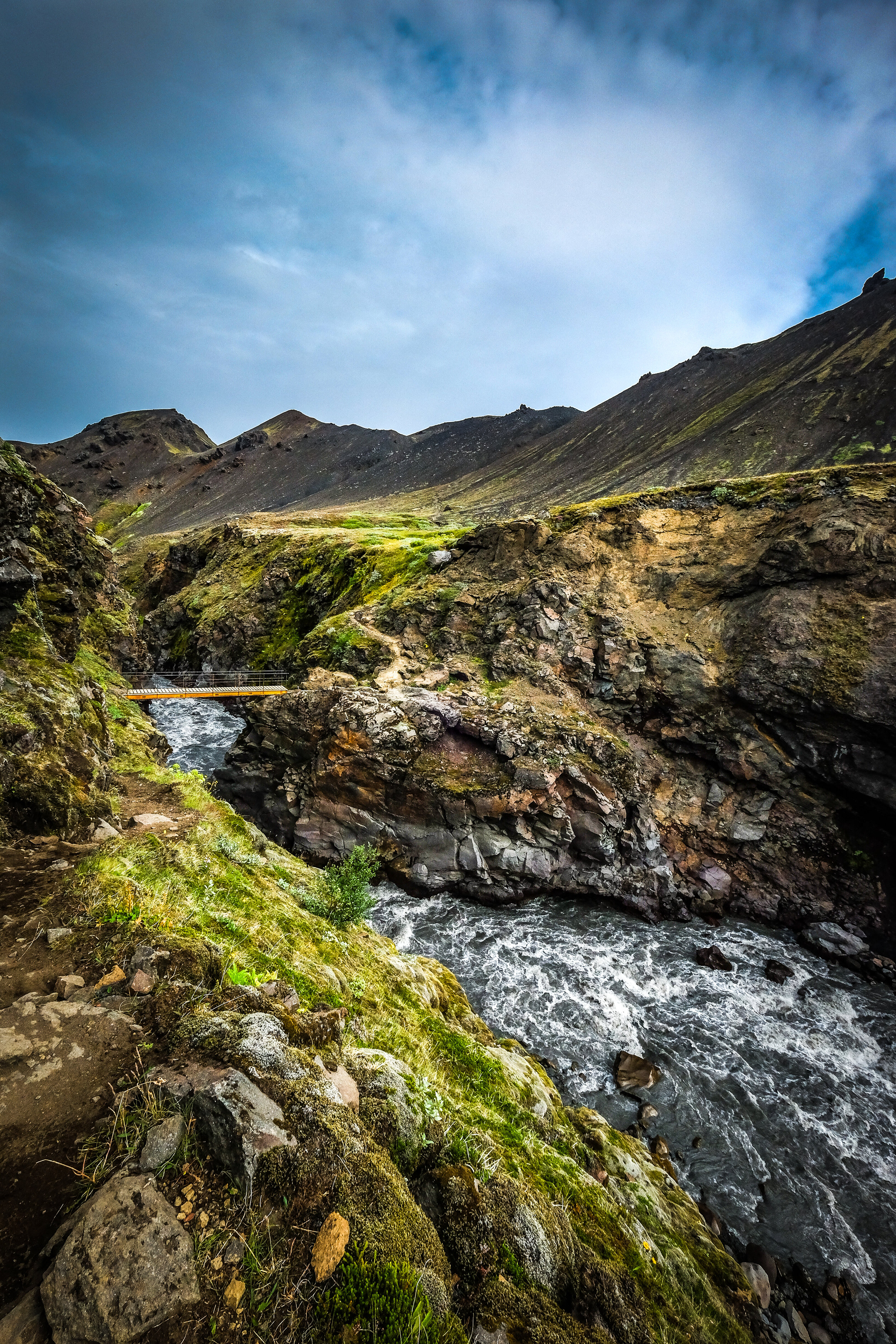
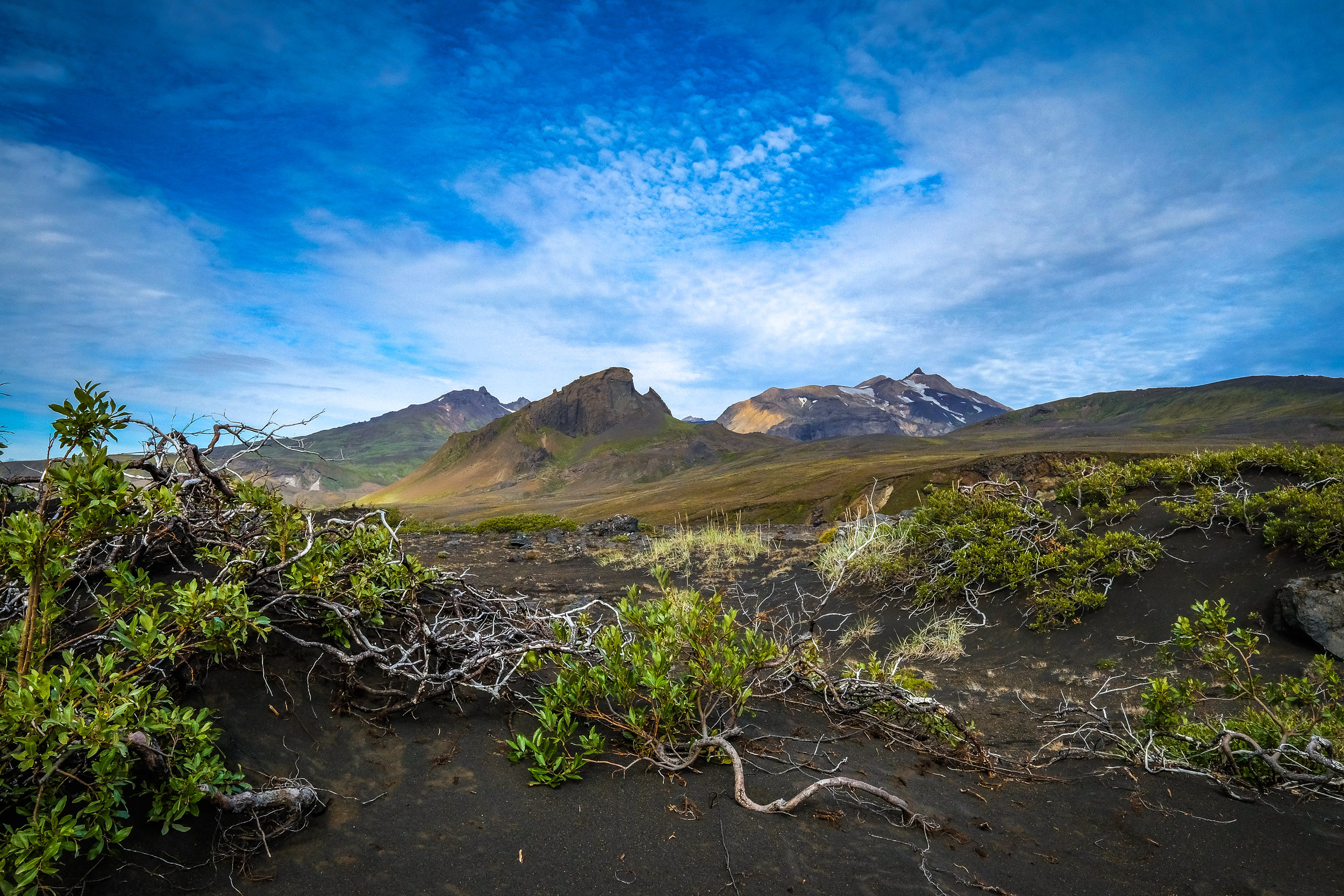
Heading out from our very windy campsite at Hrafntinnusker, the terrain was completely different than that of the previous day’s hike. It’s like we came over a hill from the camp and arrived on another planet completely. Colorful rhyolite mountains come to an end and we entered a vast region of dark palagonite mountains and white glaciers. I couldn’t take my finger off my camera’s shutter release button for hours. It’s the most beautiful place I’ve been! Go see for yourself.
The second half of this hike is extremely difficult if you have any knee problems (which I do). The trail is extremely steep, the dirt and rocks on the trail are loose and sharp, and Iceland has not yet learned about switchbacks! I fell more than a couple times. Matthew fell once or twice. My trekking poles saved the day again!
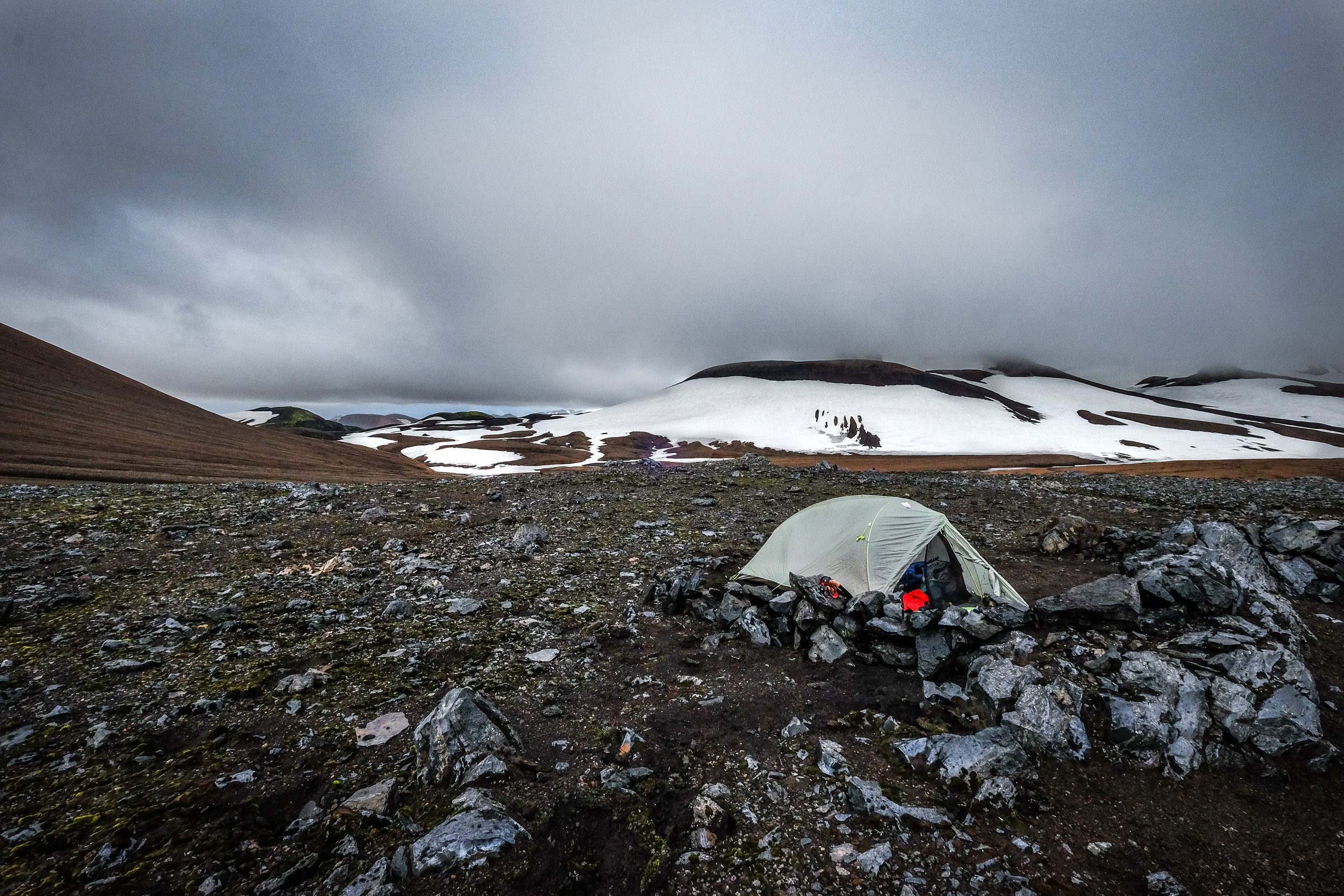
The last few kilometers to the camp site at Alftavatn are beautiful and flat. My knees recovered pretty well. At the end of this hike, we were rewarded with what has to be one of the most beautiful camping areas in the world.

DAY THREE:
Aftavatn - Botnar
Distance: 9 miles, 6-7 hours
Elevation decrease: 40 m
Start Coordinates GPS: N63°51.470 –
W19°13.640
Finish coordinates GPS: N63°45.980 – W19°22.480
Elevation decrease: 40 m
Start Coordinates GPS: N63°51.470 – W19°13.640
Finish coordinates GPS: N63°45.980 – W19°22.480
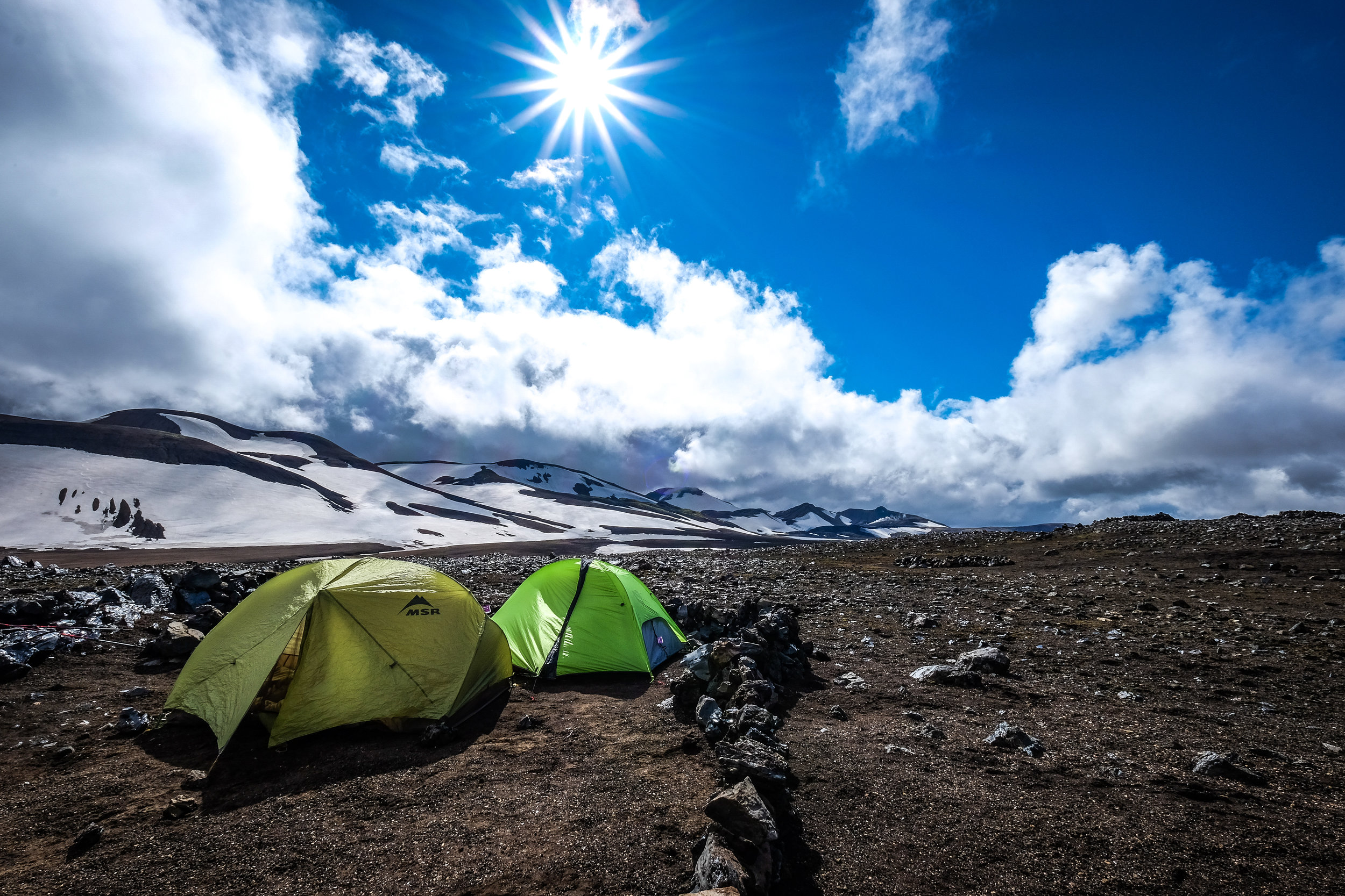
We had a pretty slow start on day three. The wind was insane (crushing our little three-season tents). Darren, our most hesitant adventurer during times of harsh weather, had decided this would be a day best spent inside his tent. “We’ve got 20 hours of daylight,” Darren shouted over the wind, “no need to hurry!”
We didn’t hurry. We waited, and waited, and waited ... and waited. Unable to wait any longer, we all got up and started packing up camp, disassembling tents, cramming our stuff in our packs, boiling water for coffee, and getting ready to hit the trail. During all the commotion, Darren never budged. We were about half a mile from the campsite, before Darren emerged from his tent to find the site almost deserted. We laughed. When Darren caught up to us, he laughed too. Well, maybe he didn’t quite bellow with laughter, but he didn’t scream and curse at us either. That was progress.
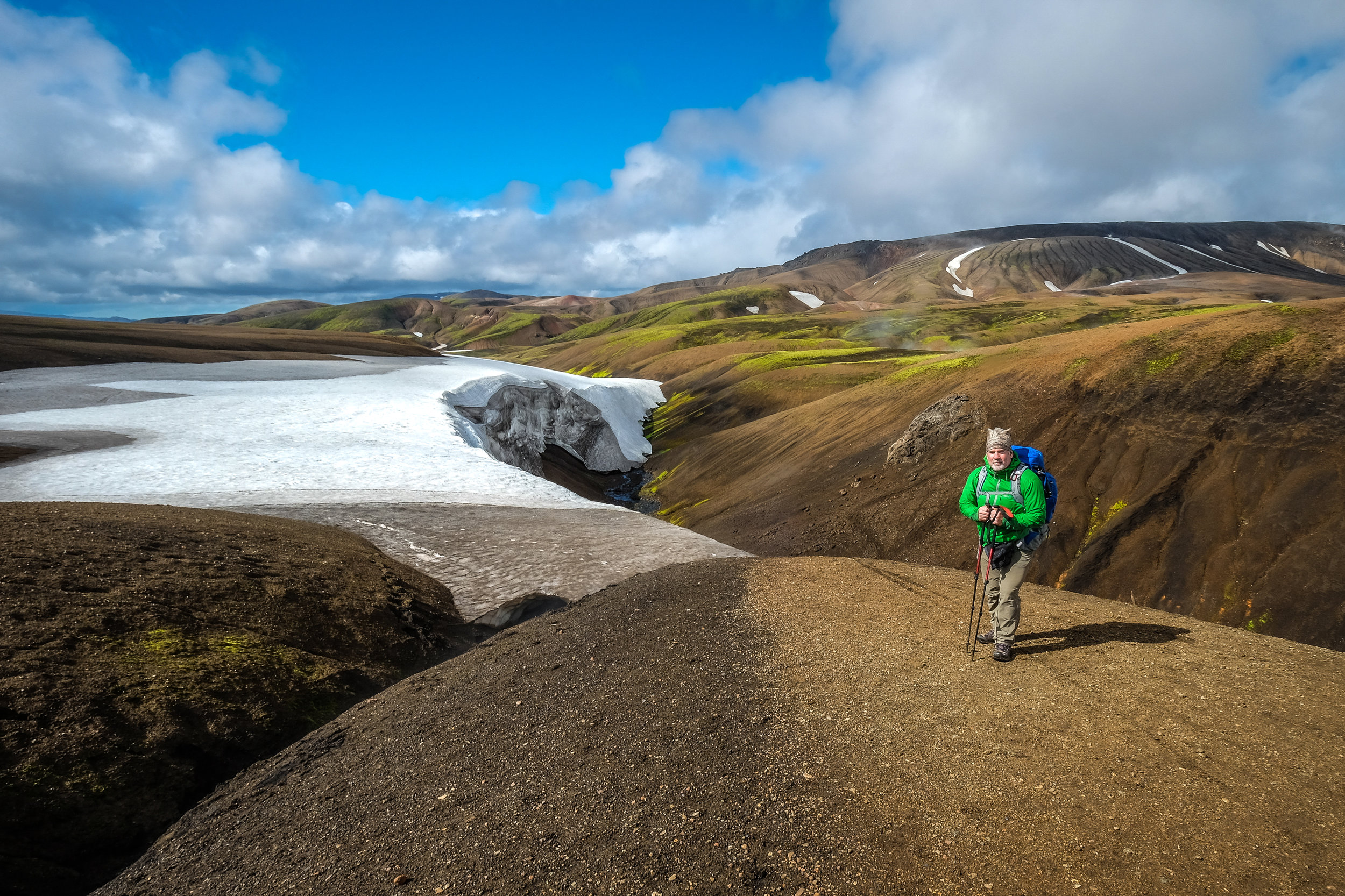
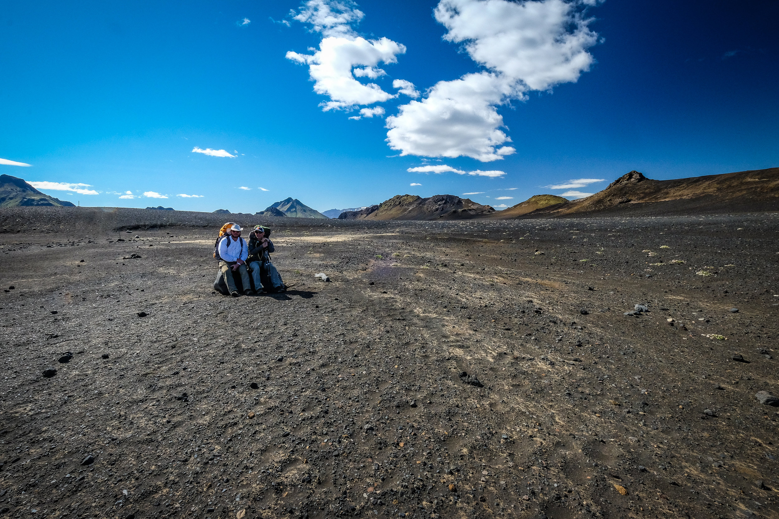
Leaving Hvanngil, we crossed a bridge over the Kaldaklofskvisl River. I think the locals have other names for these places and just use those words so they can make fun of everybody trying to pronounce or spell them. In Iceland, they probably call this the “Blue” River. But, I’ll call it Kaldaklofskvisl if that makes them laugh.
A mile or so later, we crossed another river. This one is called the Nyrori Emmstrua River (laugh away). The water in these rivers is pretty much running straight out of a melting glacier a few hundred yards away. It’s cold--like cold, cold. We crossed, put our boots back on and hoped feeling would come back to our extremities soon. We think Darren broke some sort of speed record putting on his boots and socks after the river crossing. It took him 26 minutes; we’re thinking of submitting this data to Guinness.
DAY FOUR:
Emstrur (Botnar) - Ёrsmörk
Distance: 15 km, 6 – 7 hours
Elevation decrease: 300 m
Start Coordinates GPS: N63°45.980 – W19°22.480
Finish coordinates GPS: N63°41,4 – W19°35,59
Elevation decrease: 300 m
Start Coordinates GPS: N63°45.980 – W19°22.480
Finish coordinates GPS: N63°41,4 – W19°35,59
Failing to properly plan our transportation, we ran into a little problem. We were going to be finishing up our hike about 40 miles from our car, with no way to get back to point A. What’s more, the only transportation going back to our car would put us five hours away from the nearest town (for a very fast hiker). That bus was also going to pull out at 8:30 a.m. Five hours of hiking (fast) to an 8:30 a.m. bus. Who could even do that? Not our crew. We would be stuck for an extra day.
Then we figured out that only one of us would have to make the bus. He could get the car and drive the 40 miles south to meet the rest of us near the trail’s end. One lone walker. One brave explorer.
Matthew volunteered! Even in his slightly diminished physical condition from prior adventures, he was still the best walker on the crew. Having been humbled by the scree and the loose slopes, and at least one ankle-torqueing fall, Matthew needed a win. By allowing Matthew to do the lone hike, we would be helping him regain his walking spirit. We agreed to let him set out before sunrise alone.
A five-hour hike for a fast hiker was more like a six-to-seven-hour hike for somebody with sore knees, who also happens to be an optometrist whose shoelaces took tens of minutes to tie after each water crossing.
After the last water crossing before reaching Porsmork, Kevin and I opted to hike on without Darren, knowing he would catch up with us quickly. Climbing up the hills from the river, the trail wound through a grove of very thick and small trees (the first trees we’d seen in several days).

The branches were strong and very low. Kevin and I are both pretty short and ducked under the trees without incident. We wondered how our much taller friend would fare. We got our answer a few seconds later when we heard what sounded like a buffalo slamming into a tree. Darren tried to duck under a branch at full speed. His head made it, but his backpack didn’t. “You f&*#&#^* Hobbits—slow down,” Darren yelled. We laughed. We laughed a lot.
A couple more miles and a bus ride later, we were reunited with Hegi. Tired and hungry, we drove back to Reykjavik to celebrate our return to the civilized world. Before our seafood dinner at some amazing restaurant (of which there are dozens downtown), I had a cup of soup. There were no crackers.
Go to Iceland! Explore! Trust me; you’ll love it.
See all the photos from the story here.